
襄南镇 topographic map
Interactive map
Click on the map to display elevation.
About this map
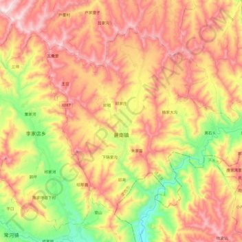
Name: 襄南镇 topographic map, elevation, terrain.
Location: 襄南镇, 通渭县, 定西市, 甘肃省, 中国 (35.00685 105.17871 35.14088 105.39176)
Average elevation: 5,955 ft
Minimum elevation: 4,764 ft
Maximum elevation: 6,998 ft
Other topographic maps
Click on a map to view its topography, its elevation and its terrain.