
华家岭镇 topographic map
Interactive map
Click on the map to display elevation.
About this map
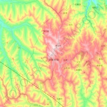
Name: 华家岭镇 topographic map, elevation, terrain.
Location: 华家岭镇, 通渭县, 定西市, 甘肃省, 中国 (35.31684 104.95677 35.45886 105.14298)
Average elevation: 7,264 ft
Minimum elevation: 6,480 ft
Maximum elevation: 8,051 ft
Other topographic maps
Click on a map to view its topography, its elevation and its terrain.