Dollo topographic map
Click on the map to display elevation.
About this map

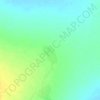
Name: Dollo topographic map, elevation, terrain.
Location: Dollo, Somali Region, Ethiopia (5.95935 44.51787 8.46175 47.98238)
Average elevation: 1,909 ft
Minimum elevation: 384 ft
Maximum elevation: 4,137 ft
Other topographic maps
Click on a map to view its topography, its elevation and its terrain.


Jijiga
Jijiga (Somali: Jigjiga, Amharic: ጅጅጋ, Jijiga) is the capital city of Somali Region, Ethiopia. It became the capital of the Somali Region in 1995 after it was moved from Gode. Located in the Fafan Zone with 70 km (37 mi) west of the border with Somalia, the city has an elevation of 1,634 metres above sea…
Average elevation: 5,682 ft
Ogaden Desert
The Ogaden is a plateau, with an elevation above sea level that ranges from 1,500 metres (4,900 ft) in the northwest, falling to about 300 metres (980 ft) along the southern limits and the Wabi Shebelle valley. The areas with altitudes between 1,400 and 1,600 metres (4,600 and 5,200 ft) are characterised as…
Average elevation: 1,916 ft

Fik'
Fiq is a town in eastern Ethiopia. Located in the Fiq Zone of the Somali Region, this town has a latitude and longitude of 08°8′N 42°18′E / 8.133°N 42.300°E / 8.133; 42.300 with an elevation of 1229 meters above sea level.
Average elevation: 3,871 ft
Fik'
Fiq, (Amharic: ፊቅ) (Somali pronunciation: [ˈfiːq], Somali pronunciation: [ˈfiːχ]; فیق), is a town in eastern Ethiopia. Located in the Erer Zone of the Somali Region, this town has a latitude and longitude of 08°8′N 42°18′E / 8.133°N 42.300°E / 8.133; 42.300 with an elevation of 1229 meters above sea level.
Average elevation: 3,871 ft
Jijiga
Jijiga (Somali: Jigjiga, Amharic: ጅጅጋ, Jijiga) is the capital city of Somali Region, Ethiopia. It became the capital of the Somali Region in 1995 after it was moved from Gode. Located in the Fafan Zone with 70 km (37 mi) west of the border with Somalia, the city has an elevation of 1,634 metres above sea…
Average elevation: 5,682 ft
Jijiga
Jijiga (Somali: Jigjiga, Amharic: ጅጅጋ, Jijiga) is the capital city of Somali Region, Ethiopia. It became the capital of the Somali Region in 1995 after it was moved from Gode. Located in the Fafan Zone with 75 km (37 mi) west of the border with Somaliland, the city has an elevation of 1,634 metres above…
Average elevation: 5,682 ft

Jijiga
Jijiga (Somali: Jigjiga, Amharic: ጅጅጋ, Jijiga) is the capital city of Somali Region, Ethiopia. It became the capital of the Somali Region in 1995 after it was moved from Gode. Located in the Fafan Zone with 75 km (37 mi) west of the border with Somaliland, the city has an elevation of 1,634 metres above…
Average elevation: 5,682 ft