
富平县 topographic map
Interactive map
Click on the map to display elevation.
About this map
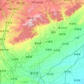
Name: 富平县 topographic map, elevation, terrain.
Location: 富平县, 渭南市, 陕西省, 中国 (34.69281 108.95466 35.11730 109.43724)
Average elevation: 2,215 ft
Minimum elevation: 1,178 ft
Maximum elevation: 4,849 ft
Other topographic maps
Click on a map to view its topography, its elevation and its terrain.