
大荔县 topographic map
Interactive map
Click on the map to display elevation.
About this map
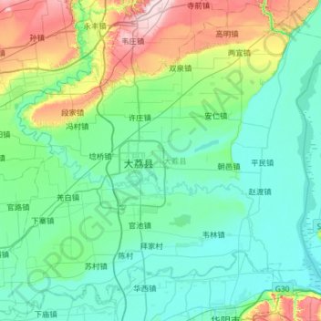
Name: 大荔县 topographic map, elevation, terrain.
Location: 大荔县, 渭南市, 陕西省, 中国 (34.56947 109.70644 35.03179 110.27951)
Average elevation: 1,257 ft
Minimum elevation: 1,070 ft
Maximum elevation: 2,031 ft
Other topographic maps
Click on a map to view its topography, its elevation and its terrain.