Geolocate

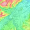
Bavaria topographic map

Click on the map to display elevation.

About this map

Name: Bavaria topographic map, elevation, terrain.

Location: Bavaria, Germany, Waldnaab (49.74272 12.16819 49.76299 12.18085)

Average elevation: 1,473 ft

Minimum elevation: 1,309 ft

Maximum elevation: 1,696 ft

Other topographic maps

Click on a map to view its topography, its elevation and its terrain.

Dietmannsried

Germany > Bavaria > Landkreis Oberallgäu

Average elevation: 2,431 ft

Hohenheim

Germany > Baden-Württemberg > Stuttgart

Average elevation: 1,253 ft

Ottenstein

Germany > Lower Saxony > Landkreis Holzminden

Average elevation: 761 ft

Lüneburg

Germany > Lower Saxony > Lüneburg

Average elevation: 115 ft

Regenstauf

Germany > Bavaria > Landkreis Regensburg

Average elevation: 1,348 ft

Hermannsburg

Germany > Lower Saxony > Landkreis Celle > Südheide

Average elevation: 233 ft

Neu-Isenburg

Germany > Hesse > Landkreis Offenbach

Average elevation: 420 ft

Kahla

Germany > Thuringia > Saale-Holzland-Kreis

Average elevation: 732 ft

Dockland

Germany > Hamburg

Average elevation: 52 ft

Nürburg

Germany > Rhineland-Palatinate > Landkreis Ahrweiler

Nürburg has a semi-continental climate with both oceanic and continental tendencies. It does however land in the former category (Köppen Cfb). With regards to the racetrack, due to the Nordschleife's varied terrain and elevation, weather may be completely different on either end of the track. The elevation…

Average elevation: 1,837 ft

Moers

Germany > North Rhine-Westphalia > Kreis Wesel

Average elevation: 92 ft

Oschersleben

Germany > Saxony-Anhalt > Börde

Average elevation: 367 ft

Wilmersdorf

Germany > Berlin

Average elevation: 154 ft

Landkreis Friesland

Germany > Lower Saxony

Average elevation: 7 ft

Bamberg

Germany > Bavaria

Average elevation: 876 ft

Lübeck

Germany > Schleswig-Holstein

Average elevation: 82 ft

Hesse

Germany

The longest rivers in Hesse are the Eder and moreover its distributary the Fulda draining most of the north, the Lahn in the centre-west and, as to those navigable by large vessels, the Main and very broad Rhine in the south. The countryside is hilly and the topographical map, inset, names 14 short, low to…

Average elevation: 1,027 ft

Oberstenfeld

Germany > Baden-Württemberg > Landkreis Ludwigsburg

Prevorst is an exclave located between the Heilbronn district and the Rems-Murr district. With an elevation of 482m it is the highest location of the Ludwigsburg district.

Average elevation: 981 ft

Rust

Germany > Baden-Württemberg > Ortenaukreis

Average elevation: 541 ft

Wilhelmsdorf

Germany > Thuringia > Saale-Orla-Kreis

Average elevation: 1,394 ft

Ragow-Merz

Germany > Brandenburg > Oder-Spree

Average elevation: 161 ft

Würzburg

Germany > Bavaria

Würzburg covers an area of 87.6 square kilometres and lies at an altitude of around 177 metres.

Average elevation: 886 ft

Waldbrunn

Germany > Bavaria > Landkreis Würzburg

Average elevation: 978 ft

Friedrichshain-Kreuzberg

Germany > Berlin

Average elevation: 148 ft

Bismark

Germany > Saxony-Anhalt > Stendal

Average elevation: 174 ft

Buchholz in der Nordheide

Germany > Lower Saxony > Harburg

Average elevation: 213 ft

Rhineland-Palatinate

Germany

Average elevation: 971 ft

Lech

Germany > Bavaria

The Lech (Latin: Licus, Licca) is a river in Austria and Germany. It is a right tributary of the Danube 255 kilometres (158 mi) in length with a drainage basin of 3,919 square kilometres (1,513 sq mi). Its average discharge at the mouth is 115 m3/s (4,100 cu ft/s). Its source is located in the Austrian state…

Average elevation: 2,608 ft

Cologne

Germany > North Rhine-Westphalia

Average elevation: 226 ft

Johannesberg

Germany > Bavaria > Landkreis Aschaffenburg

Average elevation: 876 ft

Nuremberg

Germany > Bavaria

Nuremberg has an oceanic climate (Köppen Cfb) with a certain humid continental influence (Dfb), categorized in the latter by the 0 °C isotherm. The city's climate is influenced by its inland position and higher altitude. Winters are changeable, with either mild or cold weather: the average temperature is…

Average elevation: 1,102 ft

Bremerhaven

Germany > Bremen

Average elevation: 7 ft

Steinach

Germany > Baden-Württemberg > Ortenaukreis

Average elevation: 1,214 ft

Vaale

Germany > Schleswig-Holstein > Steinburg > Vaale > Vaale

Average elevation: 36 ft

Armöd

Germany > Bavaria > Landkreis Dingolfing-Landau > Englmannsberg

Average elevation: 1,407 ft

Neu-Ulm

Germany > Bavaria > Landkreis Neu-Ulm

Average elevation: 1,634 ft

Atting

Germany > Bavaria > Landkreis Straubing-Bogen

Average elevation: 1,086 ft

City

Germany > Bavaria > Bayreuth

Average elevation: 1,142 ft

Gear up for your next adventure:

🕶️Glacier Sunglasses - Side shields to protect eyes from high-altitude snow glare
🏕️Family Camping Gear - Essentials for group camping trips
👟Men's Trail Runners - Lightweight footwear for fast-paced exploration and light hiking
🥄Camping Utensil Set - Lightweight utensils for outdoor meals
🏕️Tent Footprint - Protect your tent base from wear

As an Amazon Associate, this site earns from qualifying purchases at no extra cost to you.