

Sumy Oblast topographic map
Click on the map to display elevation.
Sumy Oblast
On its territory the Dnieper Lowland transitions east to the Central Russian Upland. The northern part of Sumy Oblast is part of the Polesie Lowland as its eastern region. Elevation is 110–240 m above sea level. Its area (23,800 km2) constitutes 3.95% of the country.
About this map
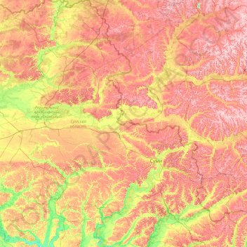
Name: Sumy Oblast topographic map, elevation, terrain.
Location: Sumy Oblast, Ukraine (50.11024 32.94260 52.36671 35.69266)
Average elevation: 558 ft
Minimum elevation: 295 ft
Maximum elevation: 889 ft
Other topographic maps
Click on a map to view its topography, its elevation and its terrain.
Hoverla
In the 20th century, the mountain increasingly gained popularity as an extreme sports site. Some routes are classified as 1A in the winter period (from late autumn to May), according to the Soviet grading system. The most popular approach to the summit starts from the tour-basa Zarosliak on the mountain's…
Average elevation: 5,469 ft














Putilovka
Ukraine > Autonomous Republic of Crimea > Bakhchysarai Raion > Голубинское сельское поселение
Average elevation: 1,129 ft

Perepilkyne
Ukraine > Autonomous Republic of Crimea > Dzhankoy Raion > Заречненское сельское поселение
Average elevation: 33 ft









Svitle
Ukraine > Autonomous Republic of Crimea > Dzhankoy Raion > Светловское сельское поселение
Average elevation: 39 ft
Zaporizhzhia
Ukraine > Zaporizhia Oblast > Zaporizhzhia
The city is located in south-eastern Ukraine. The Dnieper river splits the city for two parts between them is located the Khortytsia island. The city covers 334 km2 at an elevation of 50 m above sea level.
Average elevation: 272 ft


Varva
Varva altitude - 153 meters (501.969 ft) above sea level.
Average elevation: 417 ft


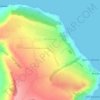
Osoviny
Ukraine > Autonomous Republic of Crimea > Lenine Raion > Глазовское сельское поселение
Average elevation: 180 ft




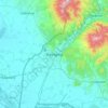




Hoverla
In the 20th century, the mountain increasingly gained popularity as an extreme sports site. Some routes are classified as 1A in the winter period (from late autumn to May), according to the Soviet grading system. The most popular approach to the summit starts from the tour-basa Zarosliak on the mountain's…
Average elevation: 5,469 ft