Geolocate
👉 Easily get elevation data in JSON, GeoTIFF and KML formats using Elevation API
Thank you for supporting this site ❤️
Make a donation

Flag Springs topographic map

Click on the map to display elevation.

About this map

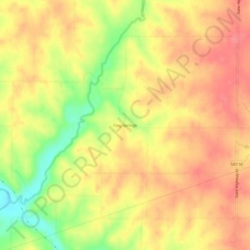
Name: Flag Springs topographic map, elevation, terrain.

Location: Flag Springs, Andrew County, Missouri, United States (40.00499 -94.68691 40.04499 -94.64691)

Average elevation: 1,030 ft

Minimum elevation: 883 ft

Maximum elevation: 1,112 ft

Andrew County trails, hiking, mountain biking, running and outdoor activities

Other topographic maps

Click on a map to view its topography, its elevation and its terrain.

Riggin Branch

United States > Missouri > Andrew County

Average elevation: 945 ft

Bolckow

United States > Missouri > Andrew County

Average elevation: 958 ft

Fillmore

United States > Missouri > Andrew County

Average elevation: 938 ft

Rea

United States > Missouri > Andrew County

Average elevation: 1,037 ft

Rosendale

United States > Missouri > Andrew County

Average elevation: 945 ft

Amazonia

United States > Missouri > Andrew County

Average elevation: 902 ft

Cosby

United States > Missouri > Andrew County

Average elevation: 932 ft

Country Club

United States > Missouri > Andrew County

Average elevation: 1,010 ft

Gear up for your next adventure:

📷Action Cameras - Rugged cameras to document your journeys across rugged terrain
📶Satellite Messenger - Communication device off‑grid
Solar GPS Watches - Advanced multisport watches with built-in topographic maps
🧭GPS Watch Accessories - Bands and chargers for GPS watches
😴Insulated Sleeping Pads - Compact and warm pads for high-elevation camping

As an Amazon Associate, this site earns from qualifying purchases at no extra cost to you.