
浠水县 topographic map
Interactive map
Click on the map to display elevation.
About this map
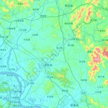
Name: 浠水县 topographic map, elevation, terrain.
Location: 浠水县, 黄冈市, 湖北省, 中国 (30.21065 114.99423 30.81513 115.62733)
Average elevation: 338 ft
Minimum elevation: 26 ft
Maximum elevation: 3,222 ft
Other topographic maps
Click on a map to view its topography, its elevation and its terrain.