
小池镇 topographic map
Interactive map
Click on the map to display elevation.
About this map
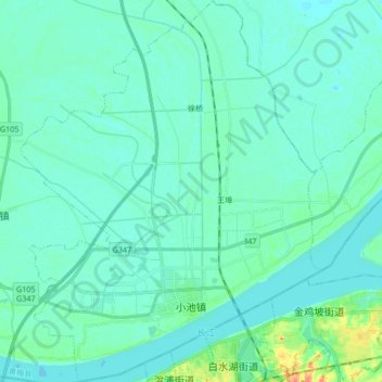
Name: 小池镇 topographic map, elevation, terrain.
Location: 小池镇, 黄梅县, 黄冈市, 湖北省, 中国 (29.72448 115.91712 29.86993 116.04913)
Average elevation: 52 ft
Minimum elevation: 26 ft
Maximum elevation: 190 ft
小池镇地处黄梅县南部长江北岸,东临刘佐乡,西接分路镇,北靠孔垄镇,距黄梅县城区40千米,行政区域面积154平方千米。地势南高北低,平均海拔15米,林地面积8.1万亩,小池镇属华阳河水系,长江过境7.9千米。
Other topographic maps
Click on a map to view its topography, its elevation and its terrain.