
隔田村 topographic map
Interactive map
Click on the map to display elevation.
About this map
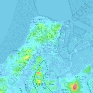
Name: 隔田村 topographic map, elevation, terrain.
Location: 隔田村, 元朗區, 新界, 香港, 中国 (22.45653 113.98306 22.49653 114.02306)
Average elevation: 20 ft
Minimum elevation: -46 ft
Maximum elevation: 331 ft
Other topographic maps
Click on a map to view its topography, its elevation and its terrain.