
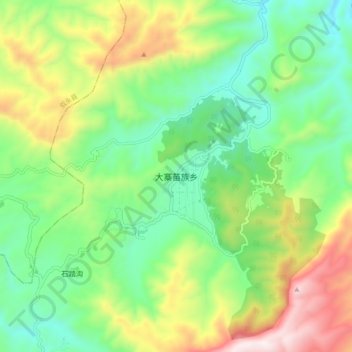
大寨苗族乡 topographic map
Interactive map
Click on the map to display elevation.
About this map
Name: 大寨苗族乡 topographic map, elevation, terrain.
Location: 大寨苗族乡, 古蔺县, 泸州市, 四川省, 中国 (28.09445 105.60385 28.17445 105.68385)
Average elevation: 3,986 ft
Minimum elevation: 2,956 ft
Maximum elevation: 5,869 ft
Other topographic maps
Click on a map to view its topography, its elevation and its terrain.