
二郎镇 topographic map
Interactive map
Click on the map to display elevation.
About this map
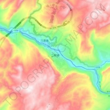
Name: 二郎镇 topographic map, elevation, terrain.
Location: 二郎镇, 古蔺县, 泸州市, 四川省, 中国 (28.10877 106.13086 28.18877 106.21086)
Average elevation: 2,549 ft
Minimum elevation: 1,027 ft
Maximum elevation: 3,747 ft
Other topographic maps
Click on a map to view its topography, its elevation and its terrain.