
金兰街道 topographic map
Interactive map
Click on the map to display elevation.
About this map
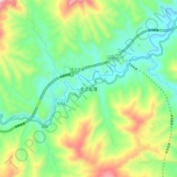
Name: 金兰街道 topographic map, elevation, terrain.
Location: 金兰街道, 古蔺县, 泸州市, 四川省, 中国 (28.01157 105.84087 28.09157 105.92087)
Average elevation: 2,149 ft
Minimum elevation: 1,240 ft
Maximum elevation: 4,016 ft
Other topographic maps
Click on a map to view its topography, its elevation and its terrain.