Geolocate

Magness topographic map

Click on the map to display elevation.

About this map

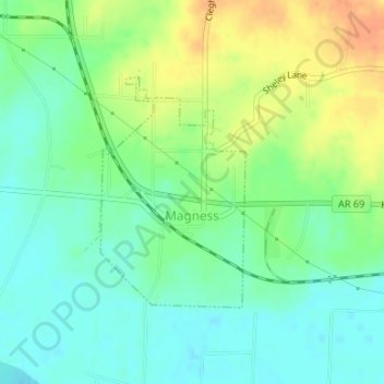
Name: Magness topographic map, elevation, terrain.

Location: Magness, Independence County, Arkansas, 72553, United States (35.69579 -91.48834 35.71201 -91.47577)

Average elevation: 279 ft

Minimum elevation: 226 ft

Maximum elevation: 354 ft

Independence County trails, hiking, mountain biking, running and outdoor activities

Other topographic maps

Click on a map to view its topography, its elevation and its terrain.

Cord

United States > Arkansas > Independence County

Average elevation: 305 ft

Desha

United States > Arkansas > Independence County

Average elevation: 318 ft

Gainsboro

United States > Arkansas > Independence County

Average elevation: 430 ft

Bethesda

United States > Arkansas > Independence County

Average elevation: 548 ft

Salado

United States > Arkansas > Independence County

Average elevation: 374 ft

Bryant

United States > Arkansas > Independence County > Southside

Average elevation: 358 ft

Charlotte

United States > Arkansas > Independence County

Average elevation: 404 ft

Limedale

United States > Arkansas > Independence County

Average elevation: 456 ft

Pfeiffer

United States > Arkansas > Independence County

Average elevation: 453 ft

Thida

United States > Arkansas > Independence County

Average elevation: 315 ft

Cushman

United States > Arkansas > Independence County > Cushman > Cushman

Average elevation: 679 ft

Floral

United States > Arkansas > Independence County

Average elevation: 774 ft

Gear up for your next adventure:

🎒Trekking Poles - Sturdy poles for balance and stability on rough terrain
🧷Carabiner Set - Durable clips for gear attachment
😴Insulated Sleeping Pads - Compact and warm pads for high-elevation camping
🪑Portable Camp Table - Compact table for campsite meals
🏥Hiking First Aid Kits - Comprehensive medical kits for remote trail injuries

As an Amazon Associate, this site earns from qualifying purchases at no extra cost to you.