
Deckers topographic map
Interactive map
Click on the map to display elevation.
About this map
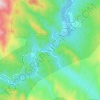
Name: Deckers topographic map, elevation, terrain.
Location: Deckers, Douglas County, Colorado, United States (39.23418 -105.24693 39.27418 -105.20693)
Average elevation: 6,759 ft
Minimum elevation: 6,358 ft
Maximum elevation: 7,621 ft
Douglas County trails, hiking, mountain biking, running and outdoor activities
Other topographic maps
Click on a map to view its topography, its elevation and its terrain.
Roxborough Park
United States > Colorado > Douglas County > Prospect Village at Sterling Ranch
Average elevation: 6,194 ft