Geolocate

Sunset Corner topographic map

Click on the map to display elevation.

About this map

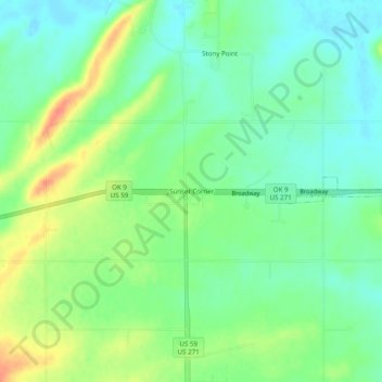
Name: Sunset Corner topographic map, elevation, terrain.

Location: Sunset Corner, Le Flore County, Oklahoma, United States (35.21843 -94.69217 35.25843 -94.65217)

Average elevation: 482 ft

Minimum elevation: 423 ft

Maximum elevation: 584 ft

Le Flore County trails, hiking, mountain biking, running and outdoor activities

Other topographic maps

Click on a map to view its topography, its elevation and its terrain.

Shady Point

United States > Oklahoma > Le Flore County

Average elevation: 459 ft

Pocola

United States > Oklahoma > Le Flore County

Average elevation: 482 ft

Fanshawe

United States > Oklahoma > Le Flore County

Average elevation: 689 ft

Le Flore

United States > Oklahoma > Le Flore County > Le Flore

Average elevation: 571 ft

Cameron

United States > Oklahoma > Le Flore County

Average elevation: 509 ft

Gear up for your next adventure:

🥾Hiking Shoes - Durable and comfortable shoes for trail hiking
💧Water Filtration Bottles - Safely drink from streams and lakes while exploring
📱Solar Portable Charger - Solar power bank for charging devices off‑grid
🦶Carbon Trekking Poles - Reduce knee impact on steep descents with ultra-light poles
🧼Biodegradable Camping Soap - Eco‑friendly soap for outdoor hygiene

As an Amazon Associate, this site earns from qualifying purchases at no extra cost to you.