
兴隆县 topographic map
Interactive map
Click on the map to display elevation.
About this map
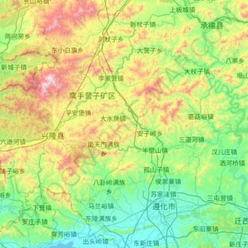
Name: 兴隆县 topographic map, elevation, terrain.
Location: 兴隆县, 承德市, 河北省, 中国 (40.19007 117.20182 40.71226 118.25344)
Average elevation: 1,598 ft
Minimum elevation: 52 ft
Maximum elevation: 6,654 ft
Other topographic maps
Click on a map to view its topography, its elevation and its terrain.