
鹰手营子矿区 topographic map
Interactive map
Click on the map to display elevation.
About this map
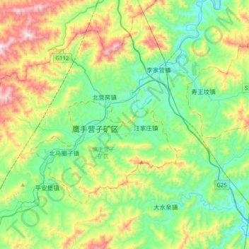
Name: 鹰手营子矿区 topographic map, elevation, terrain.
Location: 鹰手营子矿区, 承德市, 河北省, 中国 (40.47459 117.57571 40.62392 117.88480)
Average elevation: 2,231 ft
Minimum elevation: 1,230 ft
Maximum elevation: 4,551 ft
Other topographic maps
Click on a map to view its topography, its elevation and its terrain.