
Make a donation
Gear up for your next adventure:
As an Amazon Associate, this site earns from qualifying purchases at no extra cost to you.
Granite Shoals topographic map
Click on the map to display elevation.
Make a donation
Gear up for your next adventure:
As an Amazon Associate, this site earns from qualifying purchases at no extra cost to you.
About this map
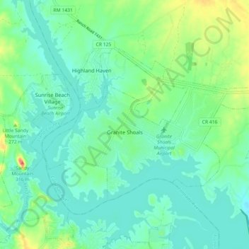
Name: Granite Shoals topographic map, elevation, terrain.
Location: Granite Shoals, Burnet County, Texas, United States (30.56775 -98.41310 30.61502 -98.32338)
Average elevation: 863 ft
Minimum elevation: 801 ft
Maximum elevation: 1,053 ft
Burnet County trails, hiking, mountain biking, running and outdoor activities
Make a donation
Gear up for your next adventure:
As an Amazon Associate, this site earns from qualifying purchases at no extra cost to you.
Other topographic maps
Click on a map to view its topography, its elevation and its terrain.
Marble Falls
United States > Texas > Burnet County > Marble Falls > Marble Falls
Average elevation: 856 ft
Make a donation
Gear up for your next adventure:
As an Amazon Associate, this site earns from qualifying purchases at no extra cost to you.