
Overstrand Local Municipality topographic map
Click on the map to display elevation.
About this map
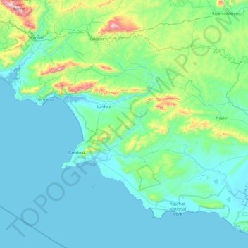
Name: Overstrand Local Municipality topographic map, elevation, terrain.
Average elevation: 466 ft
Minimum elevation: -3 ft
Maximum elevation: 3,829 ft
Other topographic maps
Click on a map to view its topography, its elevation and its terrain.
Stanford
South Africa > Western Cape > Overberg District Municipality > Overstrand Local Municipality
Average elevation: 351 ft
Hermanus
South Africa > Western Cape > Overberg District Municipality > Overstrand Local Municipality
Average elevation: 285 ft
Villiersdorp
South Africa > Western Cape > Overberg District Municipality > Theewaterskloof Local Municipality
Average elevation: 1,870 ft
Riviersonderend
South Africa > Western Cape > Overberg District Municipality > Theewaterskloof Local Municipality
Average elevation: 696 ft
Onrus River
South Africa > Western Cape > Overberg District Municipality > Overstrand Local Municipality
Average elevation: 761 ft
Hawston
South Africa > Western Cape > Overberg District Municipality > Overstrand Local Municipality
Average elevation: 194 ft
Dyer Island
South Africa > Western Cape > Overberg District Municipality > Overstrand Local Municipality
Average elevation: 0 ft
Geyser Island
South Africa > Western Cape > Overberg District Municipality > Overstrand Local Municipality
Average elevation: 0 ft
Bredasdorp
South Africa > Western Cape > Overberg District Municipality > Cape Agulhas Local Municipality
Bredasdorp is situated at an elevation of between 40 and 120 metres (130 and 390 ft) on the slopes of the Heuningberg (Afrikaans for "Honey Mountain"). There is no significant watercourse flowing through the town, although the Kars River flows past a few kilometres to the east.
Average elevation: 331 ft
Swellendam
South Africa > Western Cape > Overberg District Municipality > Swellendam Local Municipality
Average elevation: 761 ft
Grabouw
South Africa > Western Cape > Overberg District Municipality > Theewaterskloof Local Municipality
The Elgin valley is South Africa's coolest climate wine-growing region and a range of other geographic factors (for example, its proximity to the Atlantic Ocean, cool temperatures, plentiful winter rainfall, prevailing wind directions, and altitude) have created a set of conditions for wine growing which are…
Average elevation: 1,175 ft
Caledon
South Africa > Western Cape > Overberg District Municipality > Theewaterskloof Local Municipality
Average elevation: 1,020 ft
Pringle Bay
South Africa > Western Cape > Overberg District Municipality > Overstrand Local Municipality
Average elevation: 203 ft
Salt River
South Africa > Western Cape > Overberg District Municipality > Theewaterskloof Local Municipality
Average elevation: 787 ft
Mooiuitsig
South Africa > Western Cape > Overberg District Municipality > Overstrand Local Municipality
Average elevation: 568 ft