Geolocate

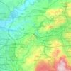
Knowley topographic map

Click on the map to display elevation.

About this map

Name: Knowley topographic map, elevation, terrain.

Location: Knowley, Chorley, Lancashire, England, PR6 9BJ, United Kingdom (53.64587 -2.62920 53.68587 -2.58920)

Average elevation: 404 ft

Minimum elevation: 233 ft

Maximum elevation: 778 ft

Other topographic maps

Click on a map to view its topography, its elevation and its terrain.

Hoghton

United Kingdom > England > Lancashire > Chorley > Hoghton

Average elevation: 341 ft

Rivington

United Kingdom > England > Lancashire > Chorley > Rivington

Average elevation: 801 ft

Heapey

United Kingdom > England > Lancashire > Chorley > Wheelton

Average elevation: 417 ft

Croston

United Kingdom > England > Lancashire > Chorley

Average elevation: 26 ft

Bretherton

United Kingdom > England > Lancashire > Chorley

Average elevation: 33 ft

Wheelton

United Kingdom > England > Lancashire > Chorley > Brinscall

Average elevation: 600 ft

Coppull

United Kingdom > England > Lancashire > Chorley

The settlement has an Anglo Saxon name describing its topography derived from the Old English copp a hill top and hyll a hill. The township was variously recorded as Cophull and Cophulle in 1277, Copphull in 1351, Copthull in 1374 and Coppull from 1444.

Average elevation: 269 ft

Clayton-le-Woods

United Kingdom > England > Lancashire > Chorley

Average elevation: 236 ft

Brindle

United Kingdom > England > Lancashire > Chorley > Brindle

Average elevation: 374 ft

Heskin

United Kingdom > England > Lancashire > Chorley

Average elevation: 184 ft

Euxton

United Kingdom > England > Lancashire > Chorley

Average elevation: 164 ft

Whittle-le-Woods

United Kingdom > England > Lancashire > Chorley

Average elevation: 289 ft

Charnock Richard

United Kingdom > England > Lancashire > Chorley

Average elevation: 230 ft

Adlington

United Kingdom > England > Lancashire > Chorley > Adlington

Average elevation: 312 ft

Moss Wood

United Kingdom > England > Lancashire > Chorley

Average elevation: 26 ft

Withnell

United Kingdom > England > Lancashire > Chorley > Abbey Village

Average elevation: 669 ft

River Darwen

United Kingdom > England > Lancashire > Chorley

Average elevation: 404 ft

Bretherton

United Kingdom > England > Lancashire > Chorley > Bretherton

Average elevation: 33 ft

Coppull

United Kingdom > England > Lancashire > Chorley

The settlement has an Anglo Saxon name describing its topography derived from the Old English copp a hill top and hyll a hill. The township was variously recorded as Cophull and Cophulle in 1277, Copphull in 1351, Copthull in 1374 and Coppull from 1444.

Average elevation: 262 ft

Gear up for your next adventure:

🛏️Cold Weather Sleeping Bag - Warm sleeping bag for cold conditions
❄️Traction Cleats - Prevent slips on icy trails during winter hikes
🦶Carbon Trekking Poles - Reduce knee impact on steep descents with ultra-light poles
🔦Powerful Headlamps - Ultra-bright hands-free lighting for night navigation
📌Outdoor GPS Map App - Apps and devices for digital topographic navigation

As an Amazon Associate, this site earns from qualifying purchases at no extra cost to you.