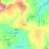
River Dee topographic map
Click on the map to display elevation.
About this map

Name: River Dee topographic map, elevation, terrain.
Location: River Dee, Wales, United Kingdom (52.90304 -3.59309 53.25333 -2.85768)
Average elevation: 515 ft
Minimum elevation: 0 ft
Maximum elevation: 2,694 ft
Other topographic maps
Click on a map to view its topography, its elevation and its terrain.








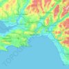
Swansea
United Kingdom > Wales > Swansea
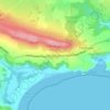
Much of Swansea is hilly with the main area of upland being located in the council ward of Mawr. Areas up to 185 metres (607 ft) in elevation range across the central section: Kilvey Hill, Townhill and Llwynmawr separate the centre of Swansea from its northern suburbs. Cefn Bryn, a ridge of high land, is the…
Average elevation: 240 ft


Maerdy Park
United Kingdom > Wales > Merthyr Tydfil County Borough > Merthyr Tydfil
Average elevation: 732 ft


Aberystwyth
United Kingdom > Wales > Ceredigion
Aberystwyth experiences an oceanic climate (Köppen climate classification Cfb) similar to almost all of the United Kingdom. This is particularly pronounced due to its west coast location facing the Irish Sea. Air undergoes little land moderation and so temperatures closely reflect the sea temperature when…
Average elevation: 128 ft

Morfa Harlech National Nature Reserve
United Kingdom > Wales > Gwynedd > Harlech
Average elevation: 10 ft

Parc Tan-y-Bwlch
United Kingdom > Wales > Gwynedd > Mynydd Llandygái > Pen Y Bwlch
Average elevation: 961 ft