Geolocate

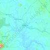
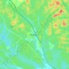
Tangkak topographic map

Click on the map to display elevation.

About this map

Name: Tangkak topographic map, elevation, terrain.

Location: Tangkak, Johor, Malaysia (2.04856 102.46729 2.48108 102.83157)

Average elevation: 157 ft

Minimum elevation: 0 ft

Maximum elevation: 3,983 ft

Other topographic maps

Click on a map to view its topography, its elevation and its terrain.
Kukup

Malaysia > Johor

Average elevation: 7 ft

Kluang

Malaysia > Johor

Average elevation: 141 ft

Desaru

Malaysia > Johor

Average elevation: 52 ft

Seri Medan

Malaysia > Johor

Average elevation: 56 ft

Sri Gading

Malaysia > Johor > Sri Gading

Average elevation: 26 ft

Taman Desa

Malaysia > Johor > Batu Pahat

Average elevation: 59 ft

Tebrau

Malaysia > Johor > Tebrau

Average elevation: 85 ft

Masai

Malaysia > Johor

Average elevation: 85 ft

Bukit Raja

Malaysia > Johor > Sungai Rengit

Average elevation: 13 ft

Sungai Sembrong

Malaysia > Johor

Average elevation: 92 ft

Segamat

Malaysia > Johor

Average elevation: 108 ft

Sempadan

Malaysia > Johor

Average elevation: 479 ft

Pulau Sibu

Malaysia > Johor

Average elevation: 16 ft

Tanjung Pengelih

Malaysia > Johor

Average elevation: 30 ft

Bekok River

Malaysia > Johor

Average elevation: 36 ft

Bukit Sepang Loi

Malaysia > Johor

Average elevation: 174 ft

Parit Sulong

Malaysia > Johor

Average elevation: 79 ft

Kampung Baru Pandan

Malaysia > Johor > Tebrau

Average elevation: 43 ft

Sungai Jeram Batu

Malaysia > Johor > Pekan Nanas

Average elevation: 33 ft

Aur Island

Malaysia > Johor

The west coast of Aur Island is influenced by the southwest monsoon that blows the wind from the Straits of Malacca during the months of May to September. The periods between the monsoons are usually marked by heavy rainfall. The mountains have lower temperature range due to their higher altitude and the…

Average elevation: 305 ft
Renggam

Malaysia > Johor

Average elevation: 200 ft

Mount Ophir

Malaysia > Johor

Average elevation: 2,756 ft

Sungai Air Merah

Malaysia > Johor > Mersing > Kampung Air Merah

Average elevation: 23 ft

Big Island

Malaysia > Johor

Average elevation: 69 ft

Kampung Raja

Malaysia > Johor

Average elevation: 30 ft

Tanjung Piai National Park

Malaysia > Johor > Piai Cape

Average elevation: 3 ft

Bukit Besi

Malaysia > Johor

Average elevation: 30 ft

Tanjung Buai

Malaysia > Johor

Average elevation: 3 ft

Gunung Besar

Malaysia > Johor

Average elevation: 2,500 ft

Gear up for your next adventure:

👖Convertible Hiking Pants - Versatile zip-off pants for changing altitudes and temperatures
👟Men's Trail Runners - Lightweight footwear for fast-paced exploration and light hiking
🏔️Mountain Trail Maps - High‑detail maps for popular peaks
🌄Hiking Binoculars - Compact binoculars for scenic views and trail spotting
🎒Outdoor Daypacks - Lightweight backpacks designed for carrying maps and essential gear

As an Amazon Associate, this site earns from qualifying purchases at no extra cost to you.