
Viga topographic map
Click on the map to display elevation.
About this map
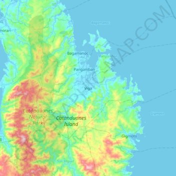
Name: Viga topographic map, elevation, terrain.
Location: Viga, Catanduanes, Bicol Region, 4805, Philippines (13.77327 124.19400 14.00453 124.56031)
Average elevation: 390 ft
Minimum elevation: -7 ft
Maximum elevation: 2,559 ft
Other topographic maps
Click on a map to view its topography, its elevation and its terrain.