
淳化县 topographic map
Interactive map
Click on the map to display elevation.
About this map
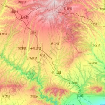
Name: 淳化县 topographic map, elevation, terrain.
Location: 淳化县, 咸阳市, 陕西省, 712000, 中国 (34.71474 108.30832 35.04197 108.82389)
Average elevation: 3,533 ft
Minimum elevation: 1,476 ft
Maximum elevation: 5,981 ft
Other topographic maps
Click on a map to view its topography, its elevation and its terrain.