Geolocate

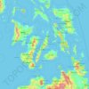
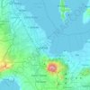
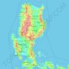
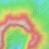
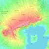
Bohol topographic map

Click on the map to display elevation.

About this map
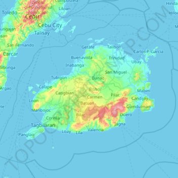
Name: Bohol topographic map, elevation, terrain.

Location: Bohol, Central Visayas, Philippines (9.35076 123.55744 10.38720 124.73522)

Average elevation: 171 ft

Minimum elevation: -7 ft

Maximum elevation: 2,943 ft

Other topographic maps

Click on a map to view its topography, its elevation and its terrain.
Villasis

Philippines > Pangasinan

Average elevation: 89 ft

Cebu City

Philippines > Cebu > Cebu City

Average elevation: 459 ft

Parañaque

Philippines

Average elevation: 46 ft

Quezon City

Philippines

Founded as a pueblo by Saint Pedro Bautista in 1590, San Francisco del Monte may be considered Quezon City's oldest district. The original land area of the old town of San Francisco del Monte was approximately2.5 square kilometres (1.0 sq mi) and covered parts of what is currently known as Project 7 and 8 and…

Average elevation: 187 ft
Baguio

Philippines

In 1903, Filipinos, Japanese and Chinese workers were hired to build Kennon Road, the first road directly connecting Baguio with the lowlands of La Union and Pangasinan. Before this, the only road to Benguet was Naguilian Road, and it was largely a horse trail at higher elevations. Camp John Hay was…

Average elevation: 2,890 ft

Dinahican

Philippines > Quezon > Infanta

Average elevation: 3 ft

Bacolod

Philippines

Bacólod (English: Bacolod), is derived from bakólod (Old Spelling: bacólod), the Old Hiligaynon (Old Ilonggo) (Old Spelling: Ylongo and Ilongo) word for a "hill, turtle, mound, rise, hillock, down, any small eminence or elevation", since the resettlement was founded on a stony, hilly area, now the barangay…

Average elevation: 161 ft
Butuan

Philippines

Average elevation: 377 ft

Balo-i

Philippines > Lanao del Norte

Average elevation: 1,280 ft

Abulug

Philippines > Cagayan

Average elevation: 7 ft

Tubungan

Philippines > Iloilo

Tubungan is 41 kilometres (25 mi) from Iloilo City. With a land area of 8,518 hectares (21,050 acres) found a hundred feet above sea level, the municipality's topography is dominated mostly by gentle rolling hills and idyllic mountains. The slope gradient ranges to as high as 25 per cent in most areas giving…

Average elevation: 502 ft
Rizal

Philippines

Average elevation: 312 ft

San Ildefonso

Philippines > Bulacan

Average elevation: 56 ft

Pili

Philippines > Camarines Sur

Average elevation: 102 ft

Binangonan

Philippines > Rizal

Average elevation: 69 ft

Marikina

Philippines

Average elevation: 262 ft

Pinamalayan

Philippines > Oriental Mindoro

Average elevation: 56 ft

Batanes

Philippines

Average elevation: 85 ft

Nueva Ecija

Philippines

Average elevation: 367 ft

Cebu

Philippines

Average elevation: 292 ft

Trece Martires

Philippines > Cavite

The city of Trece Martires is characterised with ground elevation ranging from 30m to nearly 400m. Its ground slope ranges from 0.5 to 2%.

Average elevation: 492 ft
Baybay

Philippines > Leyte > Baybay

Average elevation: 535 ft

Norzagaray

Philippines > Bulacan

Average elevation: 217 ft

Digos

Philippines > Davao del Sur > Digos

The land topography of Digos City ranges from hilly to mountainous in the north-northeast portion and flat and slightly rolling at the coastal barangays, while the urban area and the surrounding barangays in the south portion are generally flat. Generally, climate in Digos falls under the fourth type while…

Average elevation: 499 ft
Dagupan

Philippines > Pangasinan

Average elevation: 39 ft

Calamba

Philippines > Laguna

Average elevation: 328 ft

Cristo Rey

Philippines > Tarlac > Capas

Average elevation: 246 ft

Punta Silum

Philippines > Misamis Oriental

Average elevation: 79 ft

Guitnang Bayan 1

Philippines > Rizal

Average elevation: 95 ft

Taal Volcano

Philippines > Batangas > San Nicolas

Volcano Island sank from 1 to 3 m (3 to 10 ft) as a result of the eruption. It was also found that the southern shore of Lake Taal sank in elevation from the eruption. No evidences of lava could be discovered anywhere, nor have geologists been able to trace any visible records of a lava flow having occurred at…

Average elevation: 299 ft
Legazpi

Philippines > Albay

Legazpi's topography is generally plain on the northeastern areas, with slopes ranging from five to fifteen degrees. The southern areas have mostly rolling to hilly terrain. In the city's coastal areas, the terrain varies from plain (north) to hilly (south). Legazpi is criss-crossed by several rivers including…

Average elevation: 492 ft
Tabuk

Philippines > Kalinga

Average elevation: 925 ft

Tayabas

Philippines > Quezon

Average elevation: 807 ft

Talisay

Philippines > Negros Occidental > Talisay

Average elevation: 174 ft

Iligan

Philippines

Average elevation: 751 ft

Echague

Philippines > Isabela

Average elevation: 233 ft

Dipaculao

Philippines > Aurora

Average elevation: 115 ft

Mandaluyong

Philippines

Another claims that the Spaniards named the place based on the report of a navigator named Acapulco, who saw the rolling hills frequently being lashed at by daluyong (“big waves from the sea”). This seems to confirm traditional pre-Hispanic stories that giant waves from the sea would meet the adjoining…

Average elevation: 108 ft
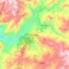
Kibungan

Philippines > Benguet

The municipality is within a cool highland mountainous zone with elevations at more than 2,500 metres (8,200 ft) above sea level. During its coolest months of December to January, Barangay Madaymen experiences chilling temperature of 0 °C (32 °F), causing the famous Frost of Madaymen.

Average elevation: 4,098 ft
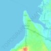
San Remigio

Philippines > Cebu

Average elevation: 23 ft

Compostela

Philippines > Cebu

Average elevation: 85 ft

Dinanum

Philippines > La Union

Average elevation: 167 ft

Aurora Hill North Central

Philippines

Average elevation: 4,852 ft

Siling Matanda

Philippines > Bulacan

Average elevation: 200 ft

Talomo River

Philippines

Average elevation: 659 ft

Taguig

Philippines

Average elevation: 128 ft

Juban

Philippines > Sorsogon

Average elevation: 98 ft

Palimbang

Philippines > Sultan Kudarat

Average elevation: 62 ft

San Jose

Philippines > Dinagat Islands

Average elevation: 66 ft

Zamboanga del Sur

Philippines

Average elevation: 387 ft

Quirino

Philippines

Average elevation: 354 ft

San Pablo

Philippines > Isabela

Average elevation: 131 ft

Luna

Philippines > Isabela

Average elevation: 174 ft

Luna

Philippines > La Union

Average elevation: 26 ft

Mount Banahaw

Philippines > Quezon > Tayabas

The andesitic Banahaw volcanic complex is composed of several stratovolcanoes with Mount Banahaw, the largest with a maximum elevation of 2,170 metres (7,119 ft) above mean sea level. The summit is topped by a 1.5 by 3.5 kilometres (0.93 mi × 2.17 mi) and 210 metres (690 ft) deep crater that is breached on…

Average elevation: 5,676 ft

Leyte Gulf

Philippines

Average elevation: 0 ft

Cagayan River

Philippines > Quirino

Average elevation: 1,453 ft

Orani

Philippines > Bataan

Average elevation: 36 ft

Tanay

Philippines > Rizal

Average elevation: 105 ft

Davao City

Philippines

Average elevation: 184 ft

Tagaytay

Philippines > Cavite

The southern and eastern portions of Tagaytay are covered by hills and mountains which is generally forests, pine trees and open grasslands. The city lies along Tagaytay Ridge, a ridge stretching about 32 kilometres (20 mi) from Mount Batulao in the west to Mount Sungay in the east with elevations averaging…

Average elevation: 751 ft
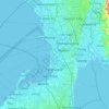
Pasay

Philippines

Average elevation: 46 ft

Vigan

Philippines > Ilocos Sur

Vigan is situated in a Quaternary Age sedimentary plain called the Vigan-Bantay Plain which is part of the Ilocos coastal plain. The Vigan-Bantay Plain is bounded on the east by a moderately rugged Miocene sediments consisting of interbedded sandstones and shale to very rugged Meta-volcanics and Meta sediment…

Average elevation: 207 ft

Sapao

Philippines > Eastern Samar

Average elevation: 39 ft

Patag Island

Philippines

Average elevation: 0 ft

Kota Island

Philippines

Average elevation: 0 ft

Lankiam Cay

Philippines

Average elevation: 0 ft

Iriga

Philippines

Average elevation: 377 ft

Davao Gulf

Philippines

Average elevation: 0 ft

Dimiao

Philippines > Bohol

Average elevation: 180 ft

Lawak Island

Philippines

Average elevation: 0 ft

San Juan

Philippines > La Union

The topography of the town is characterized by hilly and mountainous terrain that gradually rises eastward from its coastal plains along the foothills of the Cordillera Central. The town is also traversed by several creeks and rivers, with the Baroro River being the most prominent.

Average elevation: 69 ft
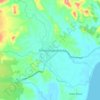
Sofronio Española

Philippines > Palawan

Average elevation: 95 ft

Quiling Sur

Philippines > Ilocos Norte

Average elevation: 56 ft

Tayuman

Philippines > Rizal > Binangonan

Average elevation: 108 ft

Surigao del Sur

Philippines

Average elevation: 899 ft

Candaba

Philippines

Average elevation: 20 ft

Davao City

Philippines

Average elevation: 213 ft

Kinatihan II

Philippines

Average elevation: 72 ft

Ibabang Bukal

Philippines

Average elevation: 833 ft

Cabatang

Philippines

Average elevation: 1,099 ft

Pinget

Philippines

Average elevation: 4,692 ft

Caloocan

Philippines

Average elevation: 266 ft

Besigan

Philippines

Average elevation: 1,916 ft

Asin

Philippines

Average elevation: 4,334 ft

Catambungan

Philippines

Average elevation: 16 ft

Tablas Strait

Philippines

Average elevation: 0 ft

Buenavista

Philippines

Average elevation: 367 ft

Poliwes

Philippines

Average elevation: 4,583 ft

Teodora Alonzo

Philippines

Average elevation: 4,787 ft

Manggahan

Philippines

Average elevation: 23 ft

Upper Agno River Basin

Philippines > Benguet

Average elevation: 4,229 ft

Bakakeng Norte

Philippines

Average elevation: 4,524 ft

Crossing Bayabas

Philippines

Average elevation: 72 ft

Marinduque

Philippines

Average elevation: 177 ft

Bakakeng Central

Philippines

Average elevation: 4,633 ft

Tarlac

Philippines

Average elevation: 358 ft

Pasig

Philippines

Average elevation: 151 ft

Pacdal

Philippines

Average elevation: 4,751 ft

Macasandig

Philippines

Average elevation: 138 ft

Gear up for your next adventure:

🪶Compact Camp Shovel - Folding shovel for campsite tasks
📡Handheld GPS Device - Reliable handheld GPS for outdoor navigation
🗺️NatGeo Topo Maps - High-quality waterproof printed topographic maps of US Parks
🪶Thermal Camp Blanket - Extra warmth for cold nights
🥾Women's Hiking Boots - Top-rated trail boots with ankle support and superior grip

As an Amazon Associate, this site earns from qualifying purchases at no extra cost to you.