
帽儿山镇 topographic map
Interactive map
Click on the map to display elevation.
About this map
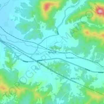
Name: 帽儿山镇 topographic map, elevation, terrain.
Location: 帽儿山镇, 哈尔滨市, 黑龙江省, 中国 (45.23431 127.47294 45.31431 127.55294)
Average elevation: 1,033 ft
Minimum elevation: 761 ft
Maximum elevation: 2,395 ft
Other topographic maps
Click on a map to view its topography, its elevation and its terrain.