
Vila do Topo topographic map
Interactive map
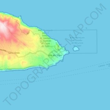
Click on the map to display elevation.
About this map
Name: Vila do Topo topographic map, elevation, terrain.
Location: Vila do Topo, Calheta, Azores, 9875-168, Portugal (38.50629 -27.80582 38.58629 -27.72582)
Average elevation: 197 ft
Minimum elevation: 0 ft
Maximum elevation: 1,886 ft
Other topographic maps
Click on a map to view its topography, its elevation and its terrain.
Nature Park of Arrábida
This group is oriented east-northeast to west-southwest, covering an area of about 35 kilometres (22 mi) long and 6 kilometres (3.7 mi) wide, and reaching 501 metres (1,644 ft) at its highest altitude as a result of the Formosinho anticline. Arrábida was formed from four successive phases of rifting that…
Average elevation: 148 ft
Douro International and Águeda River Valley Special Protection Area
Average elevation: 1,978 ft
Ilha Graciosa
The interior of the island is generally flat and dotted by numerous volcanic cones, with a southern portion of the island higher in altitude. The island is divided into four geomorphological zones.
Average elevation: 213 ft
Fátima
Fátima sits on a plateau at approximately 356 metres (1,168 ft) above sea level, being at a much higher altitude than the rest of the parishes in Ourém. This plateau represents the northernmost portion of the Estremadura Limestone Massif, which was created during the Middle Jurassic and is characterized by…
Average elevation: 1,178 ft
Vila Real de Santo António
The topography of the municipality is diverse. Marshes are common, especially north of the city where a section of the salty wetlands became the Castro Marim and Vila Real de Santo António Marsh Natural Reserve (established in 1975, this was continental Portugal's first nature reserve). Woodlands cover the…
Average elevation: 43 ft
Seixal
Although the municipal population continued to grow with development, after the 1970s there was a boom in the population, due to improvements in accessibility and mobility, principally due to public transport, its location to Lisbon and installation of economic activities within the territory. This growth…
Average elevation: 125 ft
Bragança
In 1442, King Afonso V established the hereditary dukedom of the Duchy of Braganza, for his uncle Afonso, Count of Barcelos, becoming one of the oldest fiefdoms in Portugal. The second Duke of Braganza, Fernando, reinforced his grandfather's frontier strategy and expanded his territory by integrating the lands…
Average elevation: 2,520 ft
Santo Tirso
The highest point in the municipality is in the Alto de S. Jorge, in the parish of Refojos, with 527 meters of altitude. The municipality's current perimeter is 69 kilometres (43 miles).
Average elevation: 607 ft
Torre de Moncorvo
Torre de Moncorvo has a Mediterranean climate with warm to very hot, dry summers and cool, wet winters, depending on the altitude.
Average elevation: 1,444 ft
Seia
The municipality is limited to the north by the municipalities of Nelas and Mangualde, to the northeast by Gouveia, to the east by Manteigas, to the southeast by Covilhã, to the southwest by Arganil and to the west by Oliveira do Hospital. In this municipality is located the highest point in mainland…
Average elevation: 2,474 ft
São Miguel Island
The highest elevation on São Miguel is the Pico da Vara at 1,103 metres (3,619 ft). Lying at the eastern end of the island, it is the focus of a Special Protection Area containing the largest remnant of laurisilva forest on the island, which is home to the endemic and critically endangered bird, the Azores…
Average elevation: 200 ft
Castro Verde
The Castro Verde area is made up of extensive areas of rolling hills, geomorphological structures referred to as a peneplains, which vary in altitude from 300 to 900 ft (100–300 m.) above sea level. The area has planar relief, with a medium altitude of approximately 200 metres; the lowest point is about 110…
Average elevation: 676 ft
Braga
The district of Braga has a very rugged terrain, dominated by high altitudes to the east, close to the Spanish border and the border with the Vila Real district, and going down towards the western coast, cutting through the valleys of several rivers that flow from the north-east to the south-west.
Average elevation: 1,316 ft
Aldeia de Santo António
Portugal > Guarda > Sabugal e Aldeia de Santo António
Average elevation: 2,621 ft
Braga
The topography in the municipality is characterized by irregular valleys, interspersed by mountainous spaces, fed by rivers running in parallel with the principal rivers. In the north it is limited by the Cávado River, in the south by terrain of the Serra dos Picos to a height of 566 metres (1,857 ft) and…
Average elevation: 587 ft
Monchique
Monchique has a Mediterranean climate with warm to hot summers and mild, wet winters. Due to its altitude and location, right between the valley formed by the Serra de Monchique, precipitation in the winter is much larger than anywhere else on the Algarve. Its position on the southwest corner of Portugal gives…
Average elevation: 676 ft