
Whitehorse, Unorganized topographic map
Interactive map
Click on the map to display elevation.
About this map
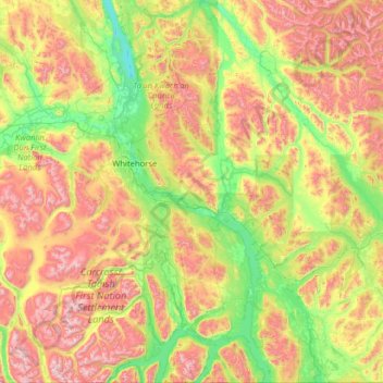
Name: Whitehorse, Unorganized topographic map, elevation, terrain.
Location: Whitehorse, Unorganized, Yukon, Canada (60.00029 -135.94105 61.24903 -134.20560)
Average elevation: 3,694 ft
Minimum elevation: 1,900 ft
Maximum elevation: 7,848 ft
Other topographic maps
Click on a map to view its topography, its elevation and its terrain.
Mount Logan
Due to active tectonic uplifting, Mount Logan is still rising in height (approximately 0.35 mm per year). Before 1992, the exact elevation of Mount Logan was unknown and measurements ranged from 5,959 to 6,050 metres (19,551 to 19,849 ft). In May 1992, a GSC expedition climbed Mount Logan and fixed the current…
Average elevation: 17,362 ft