
Riverside Park topographic map
Interactive map
Click on the map to display elevation.
About this map
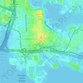
Name: Riverside Park topographic map, elevation, terrain.
Average elevation: 16 ft
Minimum elevation: -36 ft
Maximum elevation: 89 ft
Maryland trails, hiking, mountain biking, running and outdoor activities
Other topographic maps
Click on a map to view its topography, its elevation and its terrain.
Fort McHenry National Monument and Historic Shrine
United States > Maryland > Baltimore
Average elevation: 7 ft