
Bristol topographic map
Click on the map to display elevation.
About this map
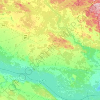
Name: Bristol topographic map, elevation, terrain.
Location: Bristol, Pontiac, Outaouais, Quebec, J0X 1G0, Canada (45.45678 -76.49332 45.68381 -76.29450)
Average elevation: 459 ft
Minimum elevation: 180 ft
Maximum elevation: 1,066 ft
Other topographic maps
Click on a map to view its topography, its elevation and its terrain.