
Halden topographic map
Interactive map
Click on the map to display elevation.
About this map
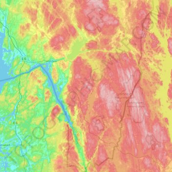
Name: Halden topographic map, elevation, terrain.
Location: Halden, Viken, Norvège (58.87689 11.15351 59.25961 11.71052)
Average elevation: 410 ft
Minimum elevation: 0 ft
Maximum elevation: 879 ft
Other topographic maps
Click on a map to view its topography, its elevation and its terrain.