
Lillestrøm topographic map
Interactive map
Click on the map to display elevation.
About this map
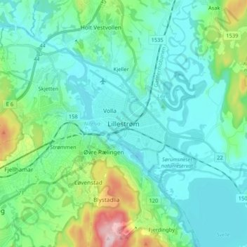
Name: Lillestrøm topographic map, elevation, terrain.
Location: Lillestrøm, Viken, 2003, Norvège (59.91592 11.00911 59.99592 11.08911)
Average elevation: 489 ft
Minimum elevation: 308 ft
Maximum elevation: 1,260 ft
Other topographic maps
Click on a map to view its topography, its elevation and its terrain.