
Norefjell topographic map
Interactive map
Click on the map to display elevation.
About this map
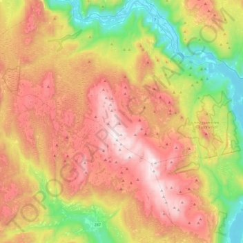
Name: Norefjell topographic map, elevation, terrain.
Location: Norefjell, Viken, 3359, Norvège (60.22404 9.21295 60.44521 9.64660)
Average elevation: 2,487 ft
Minimum elevation: 413 ft
Maximum elevation: 4,780 ft
Other topographic maps
Click on a map to view its topography, its elevation and its terrain.