
Modum topographic map
Interactive map
Click on the map to display elevation.
About this map
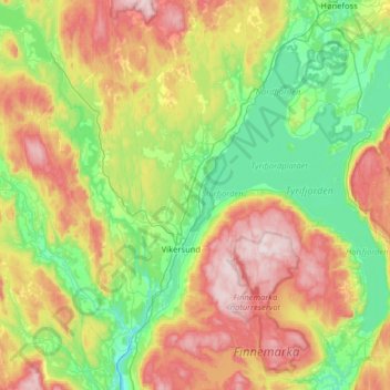
Name: Modum topographic map, elevation, terrain.
Location: Modum, Viken, Norvège (59.84975 9.71291 60.17082 10.29404)
Average elevation: 830 ft
Minimum elevation: 36 ft
Maximum elevation: 2,283 ft
Other topographic maps
Click on a map to view its topography, its elevation and its terrain.