
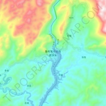
鲁布革布依族苗族乡 topographic map
Interactive map
Click on the map to display elevation.
About this map
Name: 鲁布革布依族苗族乡 topographic map, elevation, terrain.
Location: 鲁布革布依族苗族乡, 罗平县, 曲靖市, 云南省, 中国 (24.74153 104.49744 24.82153 104.57744)
Average elevation: 3,471 ft
Minimum elevation: 2,474 ft
Maximum elevation: 5,948 ft
Other topographic maps
Click on a map to view its topography, its elevation and its terrain.