
长底布依族乡 topographic map
Interactive map
Click on the map to display elevation.
About this map
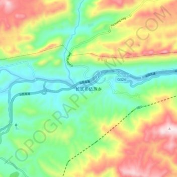
Name: 长底布依族乡 topographic map, elevation, terrain.
Location: 长底布依族乡, 罗平县, 曲靖市, 云南省, 中国 (24.99110 104.46297 25.07110 104.54297)
Average elevation: 4,856 ft
Minimum elevation: 3,970 ft
Maximum elevation: 6,299 ft
Other topographic maps
Click on a map to view its topography, its elevation and its terrain.