
大水井乡 topographic map
Interactive map
Click on the map to display elevation.
About this map
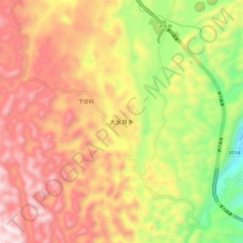
Name: 大水井乡 topographic map, elevation, terrain.
Location: 大水井乡, 罗平县, 曲靖市, 云南省, 中国 (24.70422 104.38607 24.78422 104.46607)
Average elevation: 4,577 ft
Minimum elevation: 2,730 ft
Maximum elevation: 6,115 ft
Other topographic maps
Click on a map to view its topography, its elevation and its terrain.