Geolocate

Carney Butte topographic map

Click on the map to display elevation.

About this map

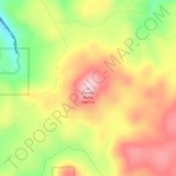
Name: Carney Butte topographic map, elevation, terrain.

Location: Carney Butte, Umatilla County, Oregon, United States (45.28116 -118.94957 45.28126 -118.94947)

Average elevation: 4,393 ft

Minimum elevation: 3,924 ft

Maximum elevation: 4,777 ft

Umatilla County trails, hiking, mountain biking, running and outdoor activities

Other topographic maps

Click on a map to view its topography, its elevation and its terrain.

Stanfield

United States > Oregon > Umatilla County

Average elevation: 633 ft

Adams

United States > Oregon > Umatilla County

Average elevation: 1,558 ft

Echo

United States > Oregon > Umatilla County

Average elevation: 696 ft

Wallula Gap

United States > Oregon > Umatilla County

Average elevation: 1,027 ft

Mission

United States > Oregon > Umatilla County

Average elevation: 1,407 ft

Gear up for your next adventure:

🧭Hiking Compass - Precision compass for reliable navigation in the wilderness
💧Water Purification System - Clean water on the trail with reliable purifiers
🔥Fast-Boil Camping Stoves - Efficient cooking systems for quick trail meals
👟Men's Trail Runners - Lightweight footwear for fast-paced exploration and light hiking
🧭Orienteering Set - Complete compass and map reading kit

As an Amazon Associate, this site earns from qualifying purchases at no extra cost to you.