Geolocate

Guion topographic map

Click on the map to display elevation.

About this map

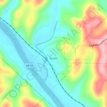
Name: Guion topographic map, elevation, terrain.

Location: Guion, Izard County, Arkansas, 72540, United States (35.92030 -91.95427 35.93452 -91.92371)

Average elevation: 466 ft

Minimum elevation: 276 ft

Maximum elevation: 814 ft

Izard County trails, hiking, mountain biking, running and outdoor activities

Other topographic maps

Click on a map to view its topography, its elevation and its terrain.

Sage

United States > Arkansas > Izard County

Average elevation: 735 ft

Mount Olive

United States > Arkansas > Izard County

Average elevation: 479 ft

Violet Hill

United States > Arkansas > Izard County

Average elevation: 761 ft

Dolph

United States > Arkansas > Izard County

Average elevation: 823 ft

Forty Four

United States > Arkansas > Izard County

Average elevation: 581 ft

Gid

United States > Arkansas > Izard County

Average elevation: 643 ft

Jumbo

United States > Arkansas > Izard County

Average elevation: 604 ft

Lunenburg

United States > Arkansas > Izard County

Average elevation: 525 ft

Sylamore

United States > Arkansas > Izard County

Average elevation: 531 ft

Wideman

United States > Arkansas > Izard County

Average elevation: 627 ft

Wiseman

United States > Arkansas > Izard County

Average elevation: 650 ft

Zion

United States > Arkansas > Izard County

Average elevation: 650 ft

Gear up for your next adventure:

🕶️GPS Smartphone Mount - Secure mount for phone navigation
🖼️Topo Map Wall Art - Decorative topographic prints of famous peaks and regions
🪶Paracord Bracelet - Survival bracelet with built‑in tools
🌡️Portable Weather Meter - Track weather conditions on the trail
Solar GPS Watches - Advanced multisport watches with built-in topographic maps

As an Amazon Associate, this site earns from qualifying purchases at no extra cost to you.