
藏南镇 topographic map
Interactive map
Click on the map to display elevation.
About this map
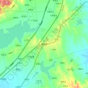
Name: 藏南镇 topographic map, elevation, terrain.
Location: 藏南镇, 青岛市, 山东省, 中国 (35.71880 119.78087 35.79880 119.86087)
Average elevation: 154 ft
Minimum elevation: 33 ft
Maximum elevation: 495 ft
Other topographic maps
Click on a map to view its topography, its elevation and its terrain.