
铁山街道 topographic map
Interactive map
Click on the map to display elevation.
About this map
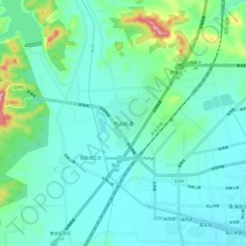
Name: 铁山街道 topographic map, elevation, terrain.
Location: 铁山街道, 青岛市, 山东省, 中国 (35.86168 119.89077 35.94168 119.97077)
Average elevation: 125 ft
Minimum elevation: 0 ft
Maximum elevation: 686 ft
Other topographic maps
Click on a map to view its topography, its elevation and its terrain.