
观山村 topographic map
Interactive map
Click on the map to display elevation.
About this map
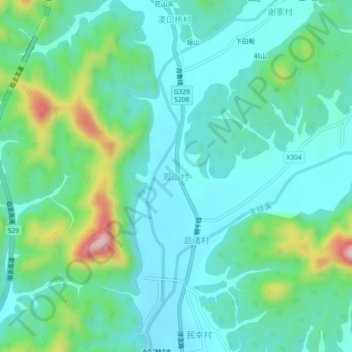
Name: 观山村 topographic map, elevation, terrain.
Location: 观山村, 杭州市, 浙江省, 中国 (30.18992 119.37022 30.22992 119.41022)
Average elevation: 509 ft
Minimum elevation: 295 ft
Maximum elevation: 1,247 ft
Other topographic maps
Click on a map to view its topography, its elevation and its terrain.