
Make a donation
Gear up for your next adventure:
As an Amazon Associate, this site earns from qualifying purchases at no extra cost to you.
Lambton topographic map
Click on the map to display elevation.
Make a donation
Gear up for your next adventure:
As an Amazon Associate, this site earns from qualifying purchases at no extra cost to you.
About this map
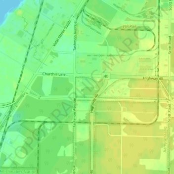
Name: Lambton topographic map, elevation, terrain.
Location: Lambton, Ontario, Canada (42.93346 -82.41672 42.93659 -82.41145)
Average elevation: 617 ft
Minimum elevation: 577 ft
Maximum elevation: 640 ft
Make a donation
Gear up for your next adventure:
As an Amazon Associate, this site earns from qualifying purchases at no extra cost to you.
Other topographic maps
Click on a map to view its topography, its elevation and its terrain.
Toronto
Despite its deep ravines, Toronto is not remarkably hilly, but its elevation does increase steadily away from the lake. Elevation differences range from 76.5 metres (251 ft) above sea level at the Lake Ontario shore to 209 m (686 ft) ASL near the York University grounds in the city's north end at the…
Average elevation: 371 ft
Ottawa
Ottawa, the capital city of Canada, is situated on the south bank of the Ottawa River at the confluence with the Rideau River. The city's topography is characterized by gently rolling terrain with elevations ranging from approximately 44 meters (144 feet) above sea level at the Ottawa River to its highest…
Average elevation: 344 ft
London
Canada > Ontario > London > London
London has a humid continental climate (Köppen Dfb), though due to its downwind location relative to Lake Huron and elevation changes across the city, it is virtually on the Dfa/Dfb (hot summer) boundary favouring the former climate zone to the southwest of the confluence of the South and North Thames Rivers,…
Average elevation: 879 ft
Make a donation
Gear up for your next adventure:
As an Amazon Associate, this site earns from qualifying purchases at no extra cost to you.
Eastern Ontario
Along the extreme western edge of Eastern Ontario is a continuation of the Laurentian Highlands, known as the Opeongo Hills, and they contain some of the highest elevations in Southern Ontario. They stretch into the northern portions of Central Ontario, near Algonquin Provincial Park.
Average elevation: 797 ft
Make a donation
Gear up for your next adventure:
As an Amazon Associate, this site earns from qualifying purchases at no extra cost to you.
Sarnia
Canada > Ontario > Lambton County
Sarnia is located on the eastern shore of Lake Huron at its extreme southern point, where it flows into the St. Clair River. Most of the surrounding area is flat, and the elevation ranges from 169 metres (554 ft) and 281 metres (922 ft) above sea level. The soil mostly comprises clay. Despite this high…
Average elevation: 610 ft
Toronto
Despite its deep ravines, Toronto is not remarkably hilly, but its elevation does increase steadily away from the lake. Elevation differences range from 76.5 metres (251 ft) above sea level at the Lake Ontario shore to 209 m (686 ft) ASL near the York University grounds in the city's north end at the…
Average elevation: 456 ft
Make a donation
Gear up for your next adventure:
As an Amazon Associate, this site earns from qualifying purchases at no extra cost to you.
Newmarket
Canada > Ontario > York Region
Newmarket's geographical coordinates are 44.05°N, 79.46°W, and its elevation above sea level is 252 m. It has an area of 38.33 km². The town is bounded on the south by Aurora, on the west by King, on the north by East Gwillimbury and on the east by Whitchurch–Stouffville.
Average elevation: 886 ft
Guelph
This region of Ontario has cold winters and warm, humid summers, falling into the Köppen climate classification Dfb zone, with moderately high rainfall and snowfall. It is generally a couple of degrees cooler than lower elevation regions on the Great Lakes shorelines, especially so in winter, the exception…
Average elevation: 1,129 ft
Make a donation
Gear up for your next adventure:
As an Amazon Associate, this site earns from qualifying purchases at no extra cost to you.
Markham
Canada > Ontario > York Region
Markham's average altitude is at 200 m (660 ft) and in general consists of gently rolling hills. The city is intersected by two rivers; the Don River and Rouge River, as well as their tributaries. To the north is the Oak Ridges Moraine, which further elevates the elevation towards the north.
Average elevation: 709 ft
Make a donation
Gear up for your next adventure:
As an Amazon Associate, this site earns from qualifying purchases at no extra cost to you.
Toronto
Despite its deep ravines, Toronto is not remarkably hilly, but its elevation does increase steadily away from the lake. Elevation differences range from 76.5 metres (251 ft) above sea level at the Lake Ontario shore to 209 m (686 ft) above sea level near the York University grounds in the city's north end at…
Average elevation: 456 ft
Make a donation
Gear up for your next adventure:
As an Amazon Associate, this site earns from qualifying purchases at no extra cost to you.
Mississauga
Canada > Ontario > Peel Region
The shoreline of former Glacial Lake Iroquois roughly follows the Dundas Street alignment, although it is not noticeable in some places but is more prominent in others, such as the site of the former brickyard (Shoreline Dr. near Mavis Rd.), the ancient shoreline promenteau affords a clear view of downtown…
Average elevation: 495 ft
North Bay
Canada > Ontario > Nipissing District
The climate in North Bay is common to most places in Northern Ontario. North Bay tends to be a less humid climate than that found in Southern Ontario due somewhat to the distance from the Great Lakes and less warm than some other locations in Northern Ontario due to cooling from Lake Nipissing. On May 31,…
Average elevation: 873 ft
Make a donation
Gear up for your next adventure:
As an Amazon Associate, this site earns from qualifying purchases at no extra cost to you.
Make a donation
Gear up for your next adventure:
As an Amazon Associate, this site earns from qualifying purchases at no extra cost to you.
Wasaga Beach
Canada > Ontario > Simcoe County
The Town of Wasaga Beach covers an area of 61.13 square kilometres (23.60 sq mi) comprised predominantly of sand and loamy sand that exhibit excessive to good drainage and irregular to moderately sloping topography. The poor soil quality makes it difficult to sustain lush lawns in the town. The Canada Land…
Average elevation: 623 ft
Lake Ontario
Lake Ontario is the easternmost of the Great Lakes and the smallest in surface area (7,340 sq mi, 18,960 km2), although it exceeds Lake Erie in volume (393 cu mi, 1,639 km3). It is the 13th largest lake in the world. When its islands are included, the lake's shoreline is 712 miles (1,146 km) long. As the last…
Average elevation: 702 ft
Make a donation
Gear up for your next adventure:
As an Amazon Associate, this site earns from qualifying purchases at no extra cost to you.
Simcoe County
The road network in Simcoe County is based on a grid pattern, with most roads running north–south or east–west. The topography of the land has permitted roads to be set in predominantly straight lines.
Average elevation: 869 ft
Make a donation
Gear up for your next adventure:
As an Amazon Associate, this site earns from qualifying purchases at no extra cost to you.
Chute-à-Blondeau
Canada > Ontario > Prescott and Russell Counties > East Hawkesbury
Average elevation: 184 ft
Make a donation
Gear up for your next adventure:
As an Amazon Associate, this site earns from qualifying purchases at no extra cost to you.
Kitchener
Canada > Ontario > Region of Waterloo
Kitchener is located in Southwestern Ontario, in the Saint Lawrence Lowlands. This geological and climatic region has wet-climate soils and deciduous forests. Situated in the Grand River Valley, the area is generally above 300 m (1,000 ft) in elevation.
Average elevation: 1,102 ft
Make a donation
Gear up for your next adventure:
As an Amazon Associate, this site earns from qualifying purchases at no extra cost to you.
Paudash Lake
Canada > Ontario > Haliburton County > Highlands East > Cardiff
Average elevation: 1,207 ft
Guelph
This region of Ontario has cold winters and warm, humid summers, falling into the Köppen climate classification Dfb zone (humid continental), with moderately high rainfall and snowfall. It is generally a couple of degrees cooler than lower elevation regions on the Great Lakes shorelines, especially so in…
Average elevation: 1,099 ft
Make a donation
Gear up for your next adventure:
As an Amazon Associate, this site earns from qualifying purchases at no extra cost to you.
Make a donation
Gear up for your next adventure:
As an Amazon Associate, this site earns from qualifying purchases at no extra cost to you.
Make a donation
Gear up for your next adventure:
As an Amazon Associate, this site earns from qualifying purchases at no extra cost to you.
Hamilton
The airport's open, rural location and higher altitude results in lower temperatures, generally windier conditions, and higher snowfall amounts than lower, built-up areas of the city. The highest temperature ever recorded in Hamilton was 41.1 °C (106 °F) on July 14, 1868. The coldest temperature ever…
Average elevation: 614 ft
Make a donation
Gear up for your next adventure:
As an Amazon Associate, this site earns from qualifying purchases at no extra cost to you.
Peterborough
Peterborough's topography is largely defined by land formations created by the receding Wisconsian glaciers 10,000–15,000 years ago. The South End and Downtown portions of the city sit on what was the bottom of the glacial Lake Peterborough—part of a glacial spillway created when glacial meltwaters from…
Average elevation: 761 ft
Make a donation
Gear up for your next adventure:
As an Amazon Associate, this site earns from qualifying purchases at no extra cost to you.
Make a donation
Gear up for your next adventure:
As an Amazon Associate, this site earns from qualifying purchases at no extra cost to you.
Windy Lake
Canada > Ontario > Sudbury District > Greater Sudbury > Onaping
Average elevation: 1,191 ft
Make a donation
Gear up for your next adventure:
As an Amazon Associate, this site earns from qualifying purchases at no extra cost to you.
Scarborough
Topographically, Scarborough is dominated by two watersheds, Highland Creek and the Rouge River. Highland Creek lies almost entirely within Scarborough and occupies approximately 70% of its total area. It occupies the western half of Scarborough, while the Rouge River flows through the eastern portion. Both of…
Average elevation: 453 ft
Make a donation
Gear up for your next adventure:
As an Amazon Associate, this site earns from qualifying purchases at no extra cost to you.
Charleston Lake
Canada > Ontario > Leeds and Grenville Counties > Leeds and the Thousand Islands > Outlet
Average elevation: 338 ft
St. Catharines
Canada > Ontario > Niagara Region
The most defining transportation icon of St. Catharines is the Welland Canal, a ship canal that runs 43.4 kilometres (27.0 mi), passing through the city. Four of its locks are within city boundaries. The canal allows shipping vessels to traverse the 99.5-metre (326.5 ft) drop in altitude from Lake Erie to Lake…
Average elevation: 338 ft
Make a donation
Gear up for your next adventure:
As an Amazon Associate, this site earns from qualifying purchases at no extra cost to you.
Make a donation
Gear up for your next adventure:
As an Amazon Associate, this site earns from qualifying purchases at no extra cost to you.
Make a donation
Gear up for your next adventure:
As an Amazon Associate, this site earns from qualifying purchases at no extra cost to you.
Peel Region
The region's climate are influenced by various air masses and weather systems from other locations, proximity to Lake Ontario, topography and elevation (e.g. Niagara Escarpment, and Oak Ridges Moraine), and urban and rural land uses. The air masses and weather systems are the major factors in influencing the…
Average elevation: 869 ft
Make a donation
Gear up for your next adventure:
As an Amazon Associate, this site earns from qualifying purchases at no extra cost to you.
Dundas
Canada > Ontario > Hamilton > Dundas
Dundas /ˈdʌnˌdæs/ is a community and former town in Hamilton, Ontario, Canada. It is nicknamed the Valley Town because of its topographical location at the bottom of the Niagara Escarpment on the western edge of Lake Ontario. The population has been stable for decades at about twenty thousand, largely…
Average elevation: 561 ft
Make a donation
Gear up for your next adventure:
As an Amazon Associate, this site earns from qualifying purchases at no extra cost to you.