
江 topographic map
Interactive map
Click on the map to display elevation.
About this map
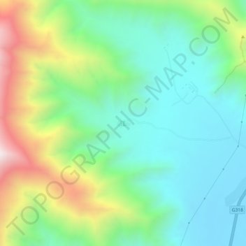
Name: 江 topographic map, elevation, terrain.
Location: 江, 拉萨市, 西藏自治区, 中国 (29.40926 90.86637 29.44926 90.90637)
Average elevation: 12,946 ft
Minimum elevation: 11,804 ft
Maximum elevation: 15,502 ft
Other topographic maps
Click on a map to view its topography, its elevation and its terrain.