
墨竹工卡县 topographic map
Interactive map
Click on the map to display elevation.
About this map
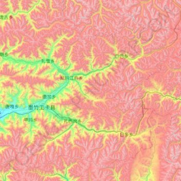
Name: 墨竹工卡县 topographic map, elevation, terrain.
Location: 墨竹工卡县, 拉萨市, 西藏自治区, 中国 (29.52270 91.54495 30.31851 92.62453)
Average elevation: 16,053 ft
Minimum elevation: 12,254 ft
Maximum elevation: 19,508 ft
墨竹工卡县地处拉萨河上游,海拔约为3810米。年平均气温6.3°C,最冷月平均气温-3.1°C,年平均降水量556毫米。
Other topographic maps
Click on a map to view its topography, its elevation and its terrain.