
堆龙德庆区 topographic map
Interactive map
Click on the map to display elevation.
About this map
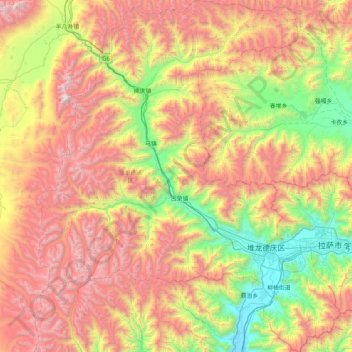
Name: 堆龙德庆区 topographic map, elevation, terrain.
Location: 堆龙德庆区, 拉萨市, 西藏自治区, 中国 (29.43444 90.46844 30.14936 91.17416)
Average elevation: 15,558 ft
Minimum elevation: 11,814 ft
Maximum elevation: 20,420 ft
Other topographic maps
Click on a map to view its topography, its elevation and its terrain.