
马镇 topographic map
Interactive map
Click on the map to display elevation.
About this map
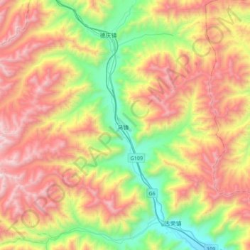
Name: 马镇 topographic map, elevation, terrain.
Location: 马镇, 堆龙德庆区, 拉萨市, 西藏自治区, 中国 (29.76289 90.53447 29.96218 90.86888)
Average elevation: 15,545 ft
Minimum elevation: 12,333 ft
Maximum elevation: 19,459 ft
Other topographic maps
Click on a map to view its topography, its elevation and its terrain.