Geolocate

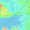
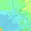
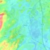
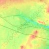
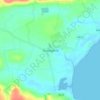
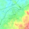
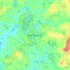
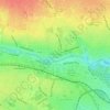
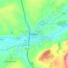
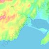
Waterdale topographic map

Click on the map to display elevation.

About this map

Name: Waterdale topographic map, elevation, terrain.

Location: Waterdale, Claregalway Electoral Division, Athenry-Oranmore Municipal District, County Galway, Connacht, Ireland (53.35727 -8.98125 53.37428 -8.93448)

Average elevation: 39 ft

Minimum elevation: 16 ft

Maximum elevation: 95 ft

Other topographic maps

Click on a map to view its topography, its elevation and its terrain.
Cork

Ireland > County Cork > Cork

Average elevation: 308 ft

Galway City

Ireland > Galway City

Average elevation: 85 ft

Lisgoold

Ireland > County Cork

Average elevation: 367 ft

River Shannon

Ireland

Average elevation: 128 ft

Furry Glen

Ireland

Average elevation: 144 ft

Dowth

Ireland

Average elevation: 105 ft

Spinans Hill

Ireland

Average elevation: 801 ft

Tibberaghny Castle

Ireland

Average elevation: 59 ft

Mine Head

Ireland

Average elevation: 72 ft

Mace Head

Ireland

Average elevation: 10 ft

Galway Bay

Ireland

Average elevation: 0 ft

Kildare

Ireland > Kildare

Average elevation: 335 ft

Killarney

Ireland > County Kerry > Killarney

Average elevation: 217 ft

Cromane

Ireland

Average elevation: 10 ft

Maghera Strand

Ireland

Average elevation: 121 ft

Knockdrin

Ireland

Average elevation: 315 ft

Ballycurry

Ireland

Average elevation: 584 ft

Ballyedmond

Ireland

Average elevation: 240 ft

Trout Lake

Ireland

Average elevation: 266 ft

Tory Hill

Ireland

Average elevation: 430 ft

Great Skellig

Ireland

Average elevation: 3 ft

Gaulstown Castle

Ireland

Average elevation: 594 ft

Skeaghvasteen

Ireland

Average elevation: 318 ft

Myles Big Stone

Ireland

Average elevation: 292 ft

Kilkee Cliffs

Ireland

Average elevation: 62 ft

Dunlicky Point

Ireland

Average elevation: 59 ft

Doulus Head

Ireland

Average elevation: 52 ft

Bolus Head

Ireland

Average elevation: 92 ft

Galley Head

Ireland

Average elevation: 10 ft

Downeen Point

Ireland

Average elevation: 36 ft

Frower Point

Ireland

Average elevation: 66 ft

Knockadoon Head

Ireland

Average elevation: 20 ft

Glendoo Mountain

Ireland

Average elevation: 1,575 ft

Crohy Head Sea Arch

Ireland

Average elevation: 92 ft

Dawros Bay

Ireland

Average elevation: 20 ft

Portacloy Bay

Ireland

Average elevation: 187 ft

Doonbeg Head

Ireland

Average elevation: 105 ft

Lambs Head Bay

Ireland

Average elevation: 46 ft

Clifden Bay

Ireland

Average elevation: 135 ft

Fair Hill

Ireland > County Cork > Cork

Average elevation: 223 ft

Dollymount

Ireland

Average elevation: 20 ft

Ennis

Ireland > County Clare > Ennis

Average elevation: 66 ft

Bray

Ireland > County Wicklow > Bray

Average elevation: 190 ft

Maynooth

Ireland > County Kildare > Maynooth

Average elevation: 217 ft

Arigna

Ireland > County Roscommon

Average elevation: 400 ft

Annayalla

Ireland > County Monaghan

Average elevation: 404 ft

Inis Meáin

Ireland > County Donegal

Average elevation: 3 ft

Limerick

Ireland > County Limerick > Limerick

Limerick's climate is classified as temperate oceanic (Köppen Cfb). Met Éireann maintains a climatological weather station at Shannon Airport, 20 kilometres west of the city in County Clare. Shannon Airport records an average of 977 millimetres of precipitation annually, most of which is rain. Limerick has a…

Average elevation: 33 ft

Foyleatalure

Ireland > County Kilkenny

Average elevation: 709 ft

Ballincollig

Ireland > County Cork > Cork

Average elevation: 203 ft

Letterkenny

Ireland > County Donegal > Letterkenny

Average elevation: 305 ft

Drogheda

Ireland > County Louth > Drogheda

Average elevation: 125 ft

Shanagarry

Ireland > County Cork

Average elevation: 46 ft

Rathdrum

Ireland > Rathdrum

Average elevation: 509 ft

White’s Cross

Ireland > Cobh Municipal District

Average elevation: 338 ft

Rosslare

Ireland > Rosslare

Average elevation: 7 ft

Djouce

Ireland > County Wicklow

Average elevation: 1,752 ft

Ballybay Town Park

Ireland > County Monaghan

Average elevation: 308 ft

Spike Island

Ireland > County Cork

Average elevation: 7 ft

Naas

Ireland > Naas

Average elevation: 335 ft

Clonmel

Ireland > County Tipperary > Clonmel

Average elevation: 348 ft

Athlone

Ireland > County Westmeath > Athlone

Average elevation: 144 ft

Midleton

Ireland > Midleton

Average elevation: 138 ft

Bailieborough

Ireland > County Cavan > Bailieborough

Average elevation: 554 ft

Blessington

Ireland > County Wicklow > Blessington

Average elevation: 732 ft

Enniskerry

Ireland > County Wicklow > Enniskerry

Average elevation: 387 ft

Malahide

Ireland > County Dublin > Malahide

Average elevation: 33 ft

Rush

Ireland > County Dublin > Rush

Average elevation: 36 ft

Bray Head

Ireland > County Wicklow

Average elevation: 144 ft

Glandore

Ireland > County Cork

Average elevation: 184 ft

Magheracloone

Ireland > County Monaghan

Average elevation: 187 ft

Tarbert

Ireland > Tarbert

Average elevation: 72 ft

Murrintown

Ireland > Murrintown

Average elevation: 203 ft

Lough Salt

Ireland > Letterkenny

Average elevation: 807 ft

Gweesalia

Ireland > County Mayo

Average elevation: 26 ft

Firies

Ireland > County Kerry

Average elevation: 102 ft

Ballingarry

Ireland > County Limerick > Ballingarry

Average elevation: 318 ft

New Inn

Ireland > County Galway

Average elevation: 302 ft

Lugduff

Ireland > County Wicklow

Average elevation: 1,503 ft

Burrow Beach

Ireland > Sutton

Average elevation: 7 ft

Tynagh

Ireland > County Galway

Average elevation: 213 ft

Bellewstown

Ireland > County Meath

Average elevation: 246 ft

Tolka Valley Park

Ireland > County Dublin > Dublin

Average elevation: 144 ft

Tydavnet

Ireland > County Monaghan

Average elevation: 289 ft

Crossabeg

Ireland > County Wexford

Average elevation: 138 ft

Castlebaldwin

Ireland > County Sligo

Average elevation: 302 ft

Trim Castle Keep

Ireland > County Meath > Trim

Average elevation: 203 ft

Carlow

Ireland > Carlow

Average elevation: 207 ft

Dundalk

Ireland > County Louth > Dundalk

Average elevation: 52 ft

Dungarvan

Ireland > County Waterford

Average elevation: 98 ft

Mullingar

Ireland > County Westmeath

Average elevation: 331 ft

Swords

Ireland > County Dublin > Swords

The medieval town developed in a linear pattern along Main Street, in a roughly north-south direction. Swords has one of the best examples of this settlement pattern in the Dublin region. The round tower, 26m in height, is also an indicator of early Christian settlement. The Irish high king Brian Boru is said…

Average elevation: 92 ft

Mallow

Ireland > County Cork > Mallow

Average elevation: 348 ft

Clonakilty

Ireland > Clonakilty

Average elevation: 161 ft

Balbriggan

Ireland > County Dublin > Balbriggan

Average elevation: 82 ft

Greystones

Ireland > County Wicklow

Greystones is located south of the site of an ancient castle of the Barony of Rathdown. There was a hamlet which, like Rathdown Castle, was known as Rathdown, and which appeared on a 1712 map. This site occupied an area now known as the Grove, north of Greystones harbour, but only the ruins of a chapel, St.…

Average elevation: 161 ft

Tramore

Ireland > Tramore

Average elevation: 98 ft

Limerick

Ireland > Limerick

Limerick's climate is classified as temperate oceanic (Köppen Cfb). Met Éireann maintains a climatological weather station at Shannon Airport, 20 kilometres west of the city in County Clare. Shannon Airport records an average of 977 millimetres of precipitation annually, most of which is rain. Limerick has a…

Average elevation: 177 ft

Gear up for your next adventure:

📱Heavy-Duty Phone Cases - Drop-proof and waterproof protection for outdoor navigation
🧤Hiking Gloves - Protective gloves for rugged trails
⛺Backpacking Tents - Weight-optimized shelters for multi-day topographic surveys
🗺️NatGeo Topo Maps - High-quality waterproof printed topographic maps of US Parks
📚Navigation Handbooks - Master the art of reading topographic maps and using a compass

As an Amazon Associate, this site earns from qualifying purchases at no extra cost to you.